Mexico City Neighborhoods to Explore: 7 Areas From Roma to Tlalpan
Roma, Condesa, Coyoacán and San Ángel are classic Mexico City neighborhoods to explore. Here are 7 areas, what to see in each and how they differ.
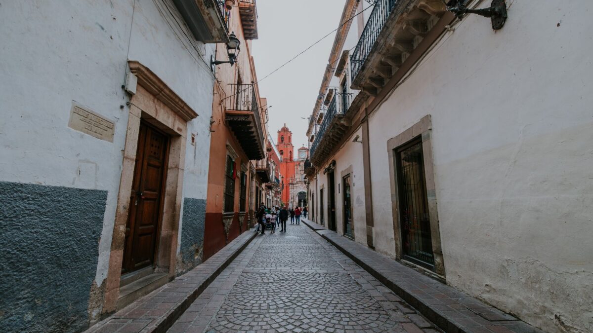
Good Mexico City neighborhoods to explore on foot include Roma and Condesa for cafés, Art Deco and Porfirian buildings, Polanco for upscale shopping and dining, Santa María la Ribera for an older, quieter side of the center, and Coyoacán, San Ángel and Tlalpan in the south for cobblestone streets and colonial plazas. Each one below has its own character and a different pace on weekdays and weekends.
The list starts in the central Cuauhtémoc and Miguel Hidalgo boroughs and then heads south. If you are choosing an area to live in rather than to visit, our comparison of the best neighborhoods in Mexico City for expats covers rents and daily life.
Santa María la Ribera, Cuauhtémoc
Colonia Santa María la Ribera sits just west of the historic center and was laid out in the late 19th century as a getaway for wealthy families. Today it mixes old mansions with small family shops, apartment blocks and some run-down buildings. The Instituto Nacional de Bellas Artes (Mexico’s national fine arts institute) has cataloged 1,040 structures here as having architectural and historic value. The city named it a “Barrio Mágico” (magical neighborhood) in 2011.
The heart of the colonia is its Alameda park and the cast-iron Morisco Kiosk, first built as Mexico’s pavilion for the 1884 World’s Fair in New Orleans and restored in 2003. The park hosts bands, chamber music and dance classes. Nearby are the Geology Institute, an Art Nouveau building from 1906 run by UNAM with fossils, minerals and landscapes by José María Velasco, and the Museo Universitario del Chopo, a glass-and-iron hall nicknamed the Crystal Palace that now shows modern and experimental art.
Where: Kiosk at Dr. Atl and Salvador Miron streets. Getting there: near Metro Buenavista.
Roma, Cuauhtémoc
Colonia Roma lies just west of the historic center and is split by Coahuila street into Roma Norte and Roma Sur. It began as an upper-class neighborhood of the Porfirio Díaz era, declined from the 1940s, and was badly hit by the 1985 earthquake. Since the 2000s it has gentrified, and it now rivals Polanco as the center of the city’s food scene. It became a “Barrio Mágico” in 2011.
Most of the restaurants, bars and clubs are in Roma Norte east of Avenida de los Insurgentes, along the boulevard Avenida Álvaro Obregón. This area holds about 1,100 mansions and other notable buildings, mostly built between 1906 and 1939 and now used as offices, galleries and cultural centers such as Casa Lamm. Galleries cluster on Colima street. West of Insurgentes, the Fuente de Cibeles fountain anchors a group of cafés and restaurants, and the old village of La Romita keeps its own street pattern in the northeast corner.
Borders: Avenida Chapultepec to the north, Insurgentes to the west, Viaducto Miguel Alemán and Eje 4 Sur to the south, Avenidas Cuauhtémoc and Jalapa to the east.
Condesa, Cuauhtémoc
Condesa is immediately west of Roma, and the two are often grouped as Condesa–Roma. It is made up of three colonias: Condesa, Hipódromo and Hipódromo Condesa. The area is known for tree-lined avenues, international restaurants, cafés, boutiques and galleries, with most bars and cafés along Amsterdam and Michoacán avenues. It is popular with students, young professionals and pet lovers.
Edificio San Martín and Edificio México are examples of 1930s Art Deco, and the curving Basurto Building faces Parque México. Tina Modotti lived at the house known as “El Barco” on Veracruz 42 from 1924 until 1926. Parque México, built on the site of an old racetrack, is the center of the neighborhood, and Avenida Ámsterdam runs in an oval around it with a planted pedestrian path down its median. The Michoacán Market, a Functionalist building from 1946, has food stands; for more food halls, see our guide to Mexico City markets including Medellín and Coyoacán.
Where: 4 to 5 km west of the Zócalo. Borders: Insurgentes Sur to the east, Eje 4 Sur (Benjamin Franklin) to the south, Circuito Interior to the west.
Polanco, Miguel Hidalgo
Polanco is an affluent district known for luxury shopping along Avenida Presidente Masaryk, upscale hotels and restaurants, embassies and cultural institutions. It was developed from 1937 on land of the former Hacienda de los Morales, and after the 1985 earthquake many of its large homes gave way to shops, offices and high-rises. A tiled obelisk to Simón Bolívar marks the entrance from Paseo de la Reforma.
For a walk, head to Polanquito, the informal name for the dining and shopping area around Pasaje Polanco and Parque Lincoln, on narrow streets such as Julio Verne and Oscar Wilde lined with Art Nouveau, Art Deco and Functionalist buildings. Many 1940s mansions in the “Colonial Californiano” style survive, some converted into businesses. The Museo Soumaya and the Colección Jumex are just north in Nuevo Polanco, which is officially a separate area.
Borders: Paseo de la Reforma to the south, Avenida Ejército Nacional to the north, Avenida General Mariano Escobedo to the east, Anillo Periférico to the west.
Villa Coyoacán, Coyoacán
The historic center of Coyoacán, known as Villa Coyoacán, is a former independent village of 29 blocks about 10 km south of the Zócalo. It has narrow cobblestone streets, small plazas and old mansions and country homes, and it became a “Barrio Mágico” in 2011. According to the borough, about 70,000 people visit each weekend, and the area is described as the most-visited place in the city after the Zócalo.
Life centers on two plazas shaded by Indian laurel trees, the Jardín del Centenario and the Jardín Hidalgo, which were renovated in 2008. On weekends they fill with street performers, musicians and dancers, plus vendors selling ice cream, esquites (seasoned corn kernels), corn on the cob and amaranth bars, with hot snacks such as quesadillas, tostadas and pozole in the evening. The streets around hold restaurants, cafés, cantinas, museums and bookstores. On weekdays the area is calmer.
Getting there: Villa Coyoacán is a stop on the Turibus and Tranvía Turístico tour routes. Parking is scarce in the historic center.
San Ángel, Álvaro Obregón
San Ángel is a small colonia in the southwest of the city, along the southern end of Avenida Insurgentes and next to UNAM’s Ciudad Universitaria. It was declared a Pueblo Típico Pintoresco (picturesque traditional town) in 1934 and a historic monument zone in 1987.
The neighborhood takes its name from the El Carmen complex, a church, former monastery and school whose three tile-covered domes are the area’s landmark. The church was built between 1624 and 1626, INAH (Mexico’s national anthropology and history institute) has looked after the complex since 1939, and the museum inside opened in 1955. San Ángel also hosts the Feria de las Flores, an annual flower fair held since 1856. The volcanic Pedregal around it includes the protected Pedregal de San Ángel area.
Postal code: 01000. Getting there: the Turibus and Tranvía Turístico routes that stop in Coyoacán also pass through San Ángel.
Tlalpan center, Tlalpan
The old center of Tlalpan, the city’s largest borough, still feels provincial, with colonial-era mansions, cobblestone streets and brightly painted façades, some turned into cafés, restaurants and museums. Like Coyoacán, it is busiest on weekends. INAH has classified eighty structures here from the 16th to the 20th centuries as historically valuable.
The main square, officially Plaza de la Constitución but known as the Jardín Principal, has a large kiosk and the Árbol de los Colgados (Tree of the Hanged). Weekend vendors sell crafts, and the cantina La Jalisciense on one side has operated for over 135 years. Facing the square are the Neoclassical former municipal palace, built between 1889 and 1900, and the San Agustín church. La Portada, beside the plaza, is a popular strip of cafés and restaurants.
Where: Plaza de la Constitución, Tlalpan.
Tips for visiting
- Plan the southern trio (Coyoacán, San Ángel and Tlalpan) for different days or start early: Coyoacán’s center is quiet on weekdays and crowded on weekends and holidays.
- Roma and Condesa sit side by side across Insurgentes, so they are easy to walk in one day.
- Driving into Villa Coyoacán is hard because parking is scarce, and informal “franeleros” charge to park on public streets.
- Marches and road closures can affect central routes; check the daily list from the city’s public security ministry, such as this list of marches and rallies, before heading out.
- Museum and fair dates and hours change, so confirm them on each venue’s official page.
Quick answers
What is the difference between Roma Norte and Roma Sur?
They are two official colonias divided by Coahuila street. Most of the restaurants, bars and landmark mansions are in Roma Norte.
Which Mexico City neighborhoods are named “Barrio Mágico”?
Among the areas in this list, Roma, Villa Coyoacán and Santa María la Ribera received the designation from the city in 2011, and Condesa and Roma together carry the “Barrio Mágico Turístico” label.
Are the Museo Soumaya and Museo Jumex in Polanco?
They are in Nuevo Polanco, officially the colonias of Granada and Ampliación Granada, just north of Polanco across Avenida Ejército Nacional.
Checked against official sources in November 2026. Hours, prices and rules change: confirm on the official page before you go or apply.