Best Viewpoints in Mexico City: Towers, Castle and Hills
The best viewpoints in Mexico City include Torre Latinoamericana, Chapultepec Castle and Cerro de la Estrella. Also Cablebús lines and tips.
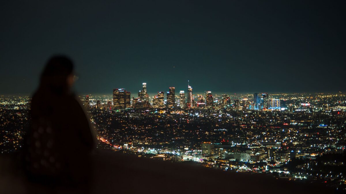
The classic skyline view in Mexico City comes from Torre Latinoamericana in the Centro Histórico, and the best green view comes from the terraces of Chapultepec Castle. For the eastern side of the valley, climb Cerro de la Estrella in Iztapalapa. The city’s Cablebús cable cars add a cheaper way to look down on the north, east and Chapultepec.
The places below are ordered from the center to the west and then out to the hills. Opening hours and ticket prices are not listed in most of the official pages, so check each place before you go.
Torre Latinoamericana, Centro Histórico
The city’s official tourism site calls the Torre Latinoamericana the most popular viewing platform of the few in Mexico City. Visitors from abroad go up, and so do longtime residents. The tower has 44 floors and was built between 1948 and 1956. It was the tallest building in the city until the Pemex Tower opened in 1982, although another paragraph on the same page gives 1972 and the World Trade Center instead, so treat that date with care.
The tower is known for being the first skyscraper successfully built in a highly active seismic zone, and it has come through several earthquakes in good condition. Besides the observation deck, the building houses the Museo del Bicentenario, the Miralto restaurant, exhibition space and a café. The official page gives the height as 166 meters in one place and 182 meters in another, so the figures differ.
It sits on the Alameda Central to Madero walking route, next to the Palacio de Bellas Artes. If you are already walking this stretch, our guide to landmarks in Centro Histórico covers what else is close by.
Getting there: on the Madero route beside Bellas Artes. Check hours and ticket prices with the tower before you go. Source: Mexico City’s official tourism site.
Torre Mayor, Paseo de la Reforma
Torre Mayor is an office tower on Paseo de la Reforma, in Cuauhtémoc. Construction ran from 1999 to 2003, and Wikipedia lists it at 225 meters and 55 floors. It was the tallest building in Latin America from 2003 until 2010.
The tower stands on the lakebed zone where much of the 1985 earthquake damage happened. It was built with 96 dampers, and the page says occupants did not notice a 7.6 earthquake in January 2003. The city’s overlooks page lists Torre Mayor and Torre Reforma as the glass and steel towers of the Reforma corridor. Because it is an office building, confirm with the building whether visitors can go up. Many people simply use it as the landmark to look at from other viewpoints.
Museo Nacional de Historia, Castillo de Chapultepec
The castle stands on top of Cerro del Chapulín in Bosque de Chapultepec, and the city’s tourism site describes it as one of the places with the best views of the city. It was an imperial and presidential residence before it became the Museo Nacional de Historia (National History Museum).
Construction began in 1785, in the viceregal period, as a summer house for the viceroy Bernardo de Gálvez. The city government bought it in 1806, and in 1833 it went to the Colegio Militar. It is the site of the battle of Chapultepec on Sept. 13, 1847, when the cadets known as the Niños Héroes defended it. The museum opened to the public in 1944 after a conversion that began in 1941. Its permanent collections cover Mexican history from the fall of Tenochtitlán in 1521 to the Revolution, with paintings, documents, clothing and furniture.
If you like museums, pair the climb with one of the nearby options in our list of art museums in Mexico City.
Hours: Tuesday to Sunday, 9:00 to 17:00. The garden and the old observatory open at the same time as the museum. Tickets: not given on the page, so check before you go. Source: Mexico City’s official tourism site.
Cerro de la Estrella, Iztapalapa
The Parque Nacional Cerro de la Estrella (Star Hill National Park) is the focal point of Iztapalapa. It has archaeological ruins, including pyramids, and a museum about an ancient ceremony. The park was declared a national park in 1938 and was larger originally; today the city has grown around it.
A restoration in 2019 and 2020 added pollinator gardens for bees, a cactus and agave garden, a playground, an outdoor exercise area and a jogging path. The path to the pyramid was rebuilt, and the park has a new mirador (lookout) and observation area. More than 18,000 trees were planted to control erosion, and lighting and signs were restored. The hill is also where the annual Passion play of Iztapalapa reaches its climax.
Getting there: take the Metro station named Cerro de la Estrella, or the Culhuacán station, which also lets you see part of the old city. Source: Mexico City’s official tourism site.
Cablebús lines 1, 2 and 3
The city’s overlooks page treats the Cablebús stations as viewpoints in their own right. Line 1 climbs through the north, with stations such as La Pastora, Campos Revolución and Ticomán, and shows how dense the hillside neighborhoods are. Line 2 crosses Iztapalapa, with panoramic stations including Quetzalcóatl, San Miguel Teotongo and Santa Marta. Line 3 runs through the four sections of Chapultepec forest toward Alameda Poniente, where the city meets the ravines.
The page does not give fares or operating hours. Check them on the official Cablebús channels before planning a ride. Source: Mexico City’s overlooks page.
Hills and volcanoes on the overlooks list
The same overlooks page also names natural viewpoints around the basin. In the north are the El Tepeyac National Park, Cerro del Chiquihuite, Cerro del Tenayo and the Guadalupe or El Borrego volcano. In the east are the Xaltepec and Yahualica volcanoes and the Peñón del Marqués (Peñón Viejo), once an islet in Lake Texcoco. In the south and southwest are Cerro del Judío (Mazatépetl), Zacatépetl Park, Cerro de Xochitepec, the hermitage and viewpoint of Cerro de San Miguel, and the Xitle and Teuhtli volcanoes. The page also lists Ermita del Calvario in Tlacoyucan, in Milpa Alta. It gives addresses for many entries, so use the listing to find the one nearest your neighborhood. If you are still choosing where to live, our comparison of neighborhoods for expats may help you pick a base near a hill or a cable car line.
Tips for visiting
- Choose the viewpoint by the view you want: Torre Latinoamericana for the historic center, Chapultepec Castle for the forest, Cerro de la Estrella for Iztapalapa and the east.
- The castle is closed on Mondays, so plan that visit for Tuesday to Sunday.
- Where the official pages do not list prices or hours, confirm them directly with the venue.
- Hill parks and natural viewpoints are outdoors, so check the weather before you climb.
Quick answers
Which is the most popular viewpoint in Mexico City?
The city’s official tourism site calls Torre Latinoamericana the most popular viewing platform of the few in the city.
Can I get a view of Chapultepec without climbing a tower?
Yes. The terraces of the Castillo de Chapultepec and Line 3 of the Cablebús both give views over the forest, according to the city’s overlooks page.
How do I reach Cerro de la Estrella by Metro?
Use the Cerro de la Estrella station, or the Culhuacán station as an alternative.
Checked against official sources in November 2026. Hours, prices and rules change: confirm on the official page before you go or apply.